Geography
Lesson One:
Lesson Two:
Lesson Three:
- Review what students know about Geography.
- Go over the unit outline and unpack the SOI.
- Watch two videos (one and two). Ask them what they notice and why I would show these videos.,
- Students will follow the presentation on What is Geography and help create definitions for some terminology.
Lesson Two:
- Article Annotation: students (in pairs if they want) will read three titles and choose one article to annotate and hand in.
- Discuss the quote: “Some countries have too much history, we have too much geography” Mackenzie King. What do you think it means?
-
- Five Themes of Geography and Travel Assignment.
- Rubric.
Lesson Three:
- Compass and Latitude/Longitude Slides. Students will take notes.
- Balloon practice. Each student will be given a balloon. They need to blow it up big enough to label things on it but not so big that it will easily pop.
- Students will be asked to draw several lines on their balloons: Equator, Tropic of Cancer and Capricorn, Arctic/Antarctic circles, Prime Meridian and International date line.
- Then students will go outside to the basketball court. Using different colour chalk they will need to draw a large version of this in pairs. Check out the first slideshow below to see your work!
- Return back to the class room to work on some latitude and longitude practice.
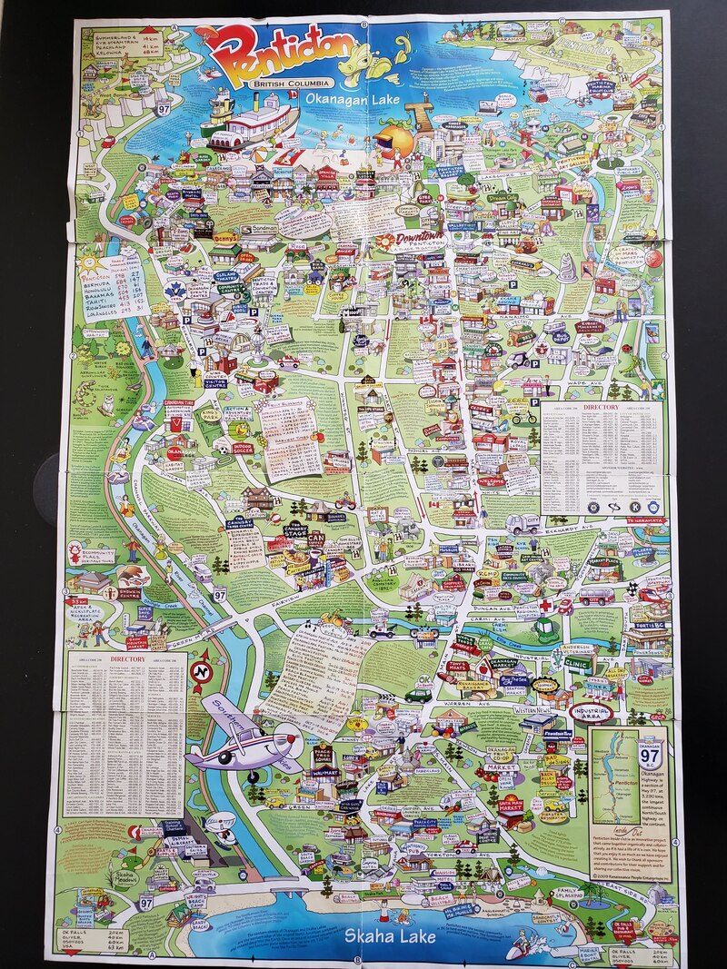
- Students will brainstorm and create a list of all of the major landmarks in Penticton. In groups students will draw a map of Penticton to practice relative vs absolute location. See the map of Penticton Inside Out for inspiration. Check out their work on the second slide show below.
Lesson Four:
Lesson Five:
Lesson Six:
- Time Zones Slides with guided notes.
- Students will then practice their time zone knowledge.
Lesson Five:
- Teach the terms relative (What is it near) vs. exact locations (GPS coordinates). Have a student take a cellphone and go hide, students will ask him/her 20 questions to try to guess where they are. If they past 20 the student wins, if they do not the class wins
- 2. Explain that we will go outside and practice relative location. Give them each a Penticton location and tell them they are that place. Get the lakes to draw there lakes at either end of the basketball court and stand at the appropriate lakes. Then ask the Channel kid to draw the channel and stand on it. Then, ask kids one by one to go stand where they should and work together to figure out where they should be they have to arrange themselves on a map.
- Physical Regions of Canada (map)- Knowledge of physical, environmental and human geography are crucial to a student’s development as a citizen of Canada and the world. You will design a map of Canada that includes the main physical regions of the country, the names of the provinces/territories and the names of the capital cities.
Lesson Six:
- Physical Regions Video. :Goal: You will show how the different the regions of Canada are
Role: You work for the local tourist information centre
Audience-Tourists around the world of a chosen target
Situation- You have been asked to make a video promoting your region in Canada, you will share its key features and tourist destinations
Products- A video
Standards: Knowledge, Communication, Investigating
